
City
Ulsan
South Korea
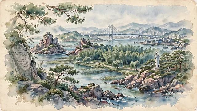
What guided this image
- Landmarks
- Daewangam Park; Taehwagang National Garden; Ulsan Bridge; Bangudae Petroglyphs; Korean coastal and riverine flora; East Sea
- Viewpoint
- Favor the classic viewpoint looking across the landscape toward the signature landmarks of Ulsan, showing regional foliage and foreground textures, the iconic architectural monuments in the middle-ground, and the distant horizon fading in the background.
- Palette
- Green should be the predominant color, especially in dense coastal red pines in Daewangam Park, soaring bamboo groves, and weeping willows.
Population1,098,421Wikidata: 1,166,615
Coordinates35.54°N, 129.32°E
Area1,060 km²
Time zoneAsia/SeoulUTC+9
Solar noon12:23clock runs 0.4 h ahead of the sun
Through the Earth
Dig straight through the Earth from Ulsan and you surface nearest to Barra del Chuy, Uruguay — 317 km from the exact antipodal point.
Nearest cities in the atlas
| Busan | KR | 56 km |
| Changwon | KR | 67 km |
| Daegu | KR | 75 km |
| Daejeon | KR | 196 km |
| Gwangju | KR | 222 km |
| Fukuoka | JP | 238 km |
| Suwon | KR | 284 km |
| Seoul | KR | 308 km |
Twinned cities
- Changchun CN
- Chennai IN
- Montevideo UY
3 of 9 twinned cities are in this atlas. See the full network →
This city sits on
- South Koreacountry
- 35Nparallel
- UTC+9offset