
City
Ibadan
Nigeria
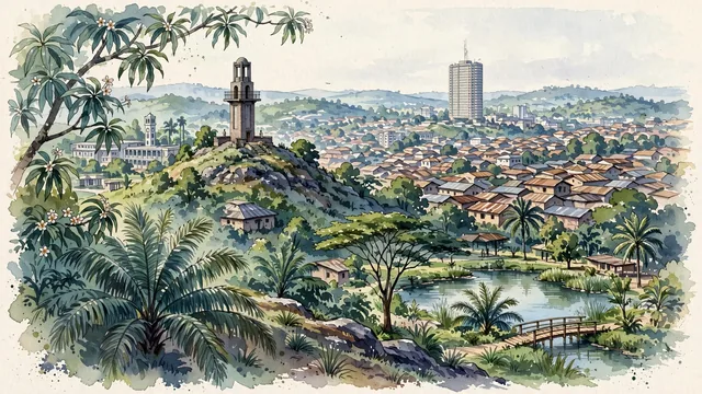
What guided this image
- Landmarks
- Bower's Tower; Ibadan's; Cocoa House; University of Ibadan; Agodi Gardens; Yoruba; lush West African rainforest and derived savanna flora; Yoruba
- Viewpoint
- Favor the classic viewpoint looking from the slopes of Oke-Are Hill across the stone tower and rolling rooftops toward the city center, showing mango tree branches and tropical foliage in the foreground, the stone tower and undulating hill settlements in the middle-ground, and the distant modernist silhouette of Cocoa House and soft hills fading in the background.
- Palette
- Green should be the predominant color, especially in the thick tropical rainforest canopies on the hill slopes, Agodi Gardens, and mango trees.
- Guarded against
- Not Lagos, Abuja, or Abeokuta
Population3,649,000Wikidata: 2,550,593
Coordinates7.38°N, 3.91°E
Elevation230 m
Area3,080 km²
Time zoneAfrica/LagosUTC+1
Solar noon12:44clock runs 0.7 h ahead of the sun
Through the Earth
Dig straight through the Earth from Ibadan and you surface nearest to Atafu Village, Tokelau — 414 km from the exact antipodal point.
Nearest cities in the atlas
| Lagos | NG | 118 km |
| Ilorin | NG | 143 km |
| Porto-Novo | BJ | 175 km |
| Benin City | NG | 222 km |
| Lomé | TG | 328 km |
| Onitsha | NG | 346 km |
| Abuja | NG | 437 km |
| Port Harcourt | NG | 448 km |
Twinned cities
Wikidata records no twinned cities for Ibadan inside this atlas.