
City
Abuja
Capital of Nigeria
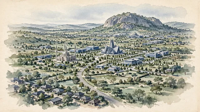
What guided this image
- Landmarks
- Aso Rock; Abuja National Mosque; National Christian Centre; National Assembly Complex
- Viewpoint
- Choose a moderately elevated view from the southwest toward the central civic district and Aso Rock, broadening the familiar rock-and-monument image with the planned streets and ordinary urban blocks that explain the city.
- Palette
- Muted botanical green should predominate in the planted avenues and seasonal vegetation, while the granite, concrete and civic buildings remain slate grey, pale neutral stone and blue-grey.
- Guarded against
- Avoid making Abuja look like lagoon-side Lagos, a Sahelian earthen-walled town, or a Dubai-like wall of skyscrapers.
Population2,690,000Wikidata: 21,000
Coordinates9.06°N, 7.50°E
Elevation360 m
Area713,000,000 km²
Time zoneAfrica/LagosUTC+1
Solar noon12:30clock runs 0.5 h ahead of the sun
Through the Earth
Dig straight through the Earth from Abuja and you surface nearest to Atafu Village, Tokelau — 58 km from the exact antipodal point.
Nearest cities in the atlas
| Kaduna | NG | 164 km |
| Jos | NG | 181 km |
| Ilorin | NG | 331 km |
| Onitsha | NG | 333 km |
| Kano | NG | 345 km |
| Benin City | NG | 366 km |
| Ibadan | NG | 437 km |
| Aba | NG | 439 km |
Twinned cities
- Brasília BR
1 of 1 twinned cities are in this atlas. See the full network →