
City
Ilorin
Nigeria
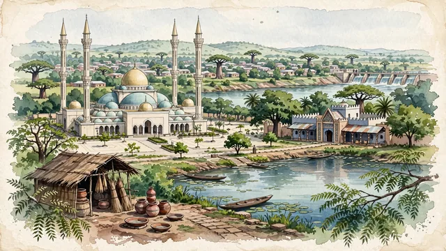
What guided this image
- Landmarks
- Ilorin Central Mosque; Emir's Palace; Dada Pottery Workshop; Asa Dam; Yoruba-Fulani; lush Middle Belt savanna and forest-mosaic flora; Fulani Jihadist
- Viewpoint
- Favor the classic viewpoint looking toward the Ilorin Central Mosque across the Oja Oba square or along the calm banks of the Asa River with the mosque minarets rising in the distance, showing neem tree branches and clay path pavers in the foreground, the sweeping mosque dome, arches, and courtyard in the middle-ground, and the soft Middle Belt plain horizon fading in the background.
- Palette
- Green should be the predominant color, especially in the thick canopies of neem and shea butter trees around the Asa River, palace gardens, and Asa Dam.
- Guarded against
- Not Ibadan, Kano, or Kaduna
Population1,080,000Wikidata: 847,582
Coordinates8.50°N, 4.54°E
Elevation986 m
Area765 km²
Time zoneAfrica/LagosUTC+1
Solar noon12:42clock runs 0.7 h ahead of the sun
Through the Earth
Dig straight through the Earth from Ilorin and you surface nearest to Atafu Village, Tokelau — 323 km from the exact antipodal point.
Nearest cities in the atlas
| Ibadan | NG | 143 km |
| Lagos | NG | 261 km |
| Benin City | NG | 269 km |
| Porto-Novo | BJ | 309 km |
| Abuja | NG | 331 km |
| Onitsha | NG | 360 km |
| Kaduna | NG | 390 km |
| Lomé | TG | 451 km |
Twinned cities
Wikidata records no twinned cities for Ilorin inside this atlas.