
City
Jos
Nigeria
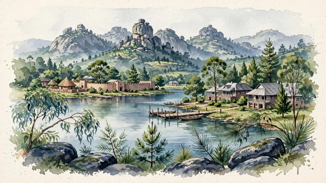
What guided this image
- Landmarks
- Shere Hills; Rayfield Resort Lake; Museum of Traditional Nigerian Architecture; Rayfield and European; Jos Wildlife Park; Berom and Anaguta; lush Jos Plateau temperate-montane flora; Nok
- Viewpoint
- Favor the classic viewpoint looking across the calm waters of Rayfield Lake toward the rocky crags of Shere Hills, showing eucalyptus branches and granite boulders in the foreground, the tranquil lake water, wooden boating wharf, and stone bungalows in the middle-ground, and the dramatic, jagged granite peaks of Shere Hills rising in the background.
- Palette
- Green should be the predominant color, especially in the thick pine and eucalyptus woodlands covering the plateau, Rayfield lakeside lawns, and montane grasslands.
- Guarded against
- Not Abuja, Kaduna, or Kano
Population1,040,000Wikidata: 622,802
Coordinates9.93°N, 8.89°E
Elevation1,217 m
Time zoneAfrica/LagosUTC+1
Solar noon12:24clock runs 0.4 h ahead of the sun
Through the Earth
Dig straight through the Earth from Jos and you surface nearest to Fale old settlement, Tokelau — 62 km from the exact antipodal point.
Nearest cities in the atlas
| Kaduna | NG | 172 km |
| Abuja | NG | 181 km |
| Kano | NG | 234 km |
| Onitsha | NG | 480 km |
| Ilorin | NG | 503 km |
| Maiduguri | NG | 513 km |
| Sokoto | NG | 528 km |
| Benin City | NG | 537 km |
Twinned cities
Wikidata records no twinned cities for Jos inside this atlas.