
City
Kano
Nigeria
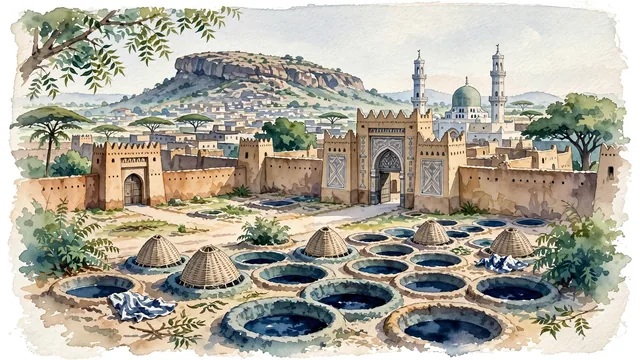
What guided this image
- Landmarks
- Gidan Rumfa; Ancient Kano City Walls; Kofar Mata Indigo Dye Pits; Dala Hill; Kano Central Mosque; Hausa; lush Sudan savanna and Sahelian flora; Hausa-Fulani
- Viewpoint
- Favor the classic viewpoint looking toward the monumental carved earthen portal of the Emir's Palace or across the round earthen vats of Kofar Mata toward the city wall and Dala Hill, showing neem tree branches and earthen ground in the foreground, the historic mud-brick architecture, dye pits, or palace gates in the middle-ground, and the rocky granite hump of Dala Hill rising in the background.
- Palette
- Green should be the predominant color, especially in the thick canopies of neem and baobab trees throughout the city, the green dome of the Emir's Palace, and courtyard gardens.
- Guarded against
- Not Kaduna, Sokoto, or Zaria
Population4,910,000Wikidata: 4,348,000
Coordinates12.00°N, 8.52°E
Elevation488 m
Area499 km²
Time zoneAfrica/LagosUTC+1
Solar noon12:26clock runs 0.4 h ahead of the sun
Through the Earth
Dig straight through the Earth from Kano and you surface nearest to Taulaga, American Samoa — 113 km from the exact antipodal point.
Nearest cities in the atlas
| Kaduna | NG | 201 km |
| Jos | NG | 234 km |
| Abuja | NG | 345 km |
| Sokoto | NG | 375 km |
| Maiduguri | NG | 505 km |
| Ilorin | NG | 584 km |
| Onitsha | NG | 678 km |
| Benin City | NG | 705 km |
Twinned cities
Wikidata records no twinned cities for Kano inside this atlas.