
City
Kigali
Capital of Rwanda
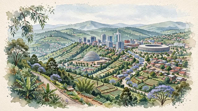
What guided this image
- Landmarks
- Kigali Convention Centre; Kigali's; Kigali Arena
- Viewpoint
- Favor an elevated panoramic viewpoint from an opposing green ridge, looking across a lush valley toward the Nyarugenge CBD ridge and the Kigali Convention Centre dome, capturing the dramatic stepped hill contours of the city.
- Palette
- Green should be the predominant color, especially in the rolling hillside vegetation, terraced agricultural slopes, tree-lined boulevards, and forested ridges.
- Guarded against
- Not a generic African city or flat tropical savanna
Population1,132,686
Coordinates1.95°S, 30.06°E
Elevation1,567 m
Area730 km²
Time zoneAfrica/KigaliUTC+2
Solar noon11:00clock runs 0.0 h behind the sun
Through the Earth
Dig straight through the Earth from Kigali and you surface in open ocean, nearest to Banana Village, Kiribati — 826 km from the exact antipodal point.
Nearest cities in the atlas
| Gitega | BI | 165 km |
| Mwanza | TZ | 322 km |
| Kampala | UG | 377 km |
| Kakamega | KE | 577 km |
| Kisangani | CD | 607 km |
| Nairobi | KE | 755 km |
| Juba | SS | 775 km |
| Dodoma | TZ | 785 km |
Twinned cities
8 of 12 twinned cities are in this atlas. See the full network →