
City
Kisangani
Democratic Republic of the Congo
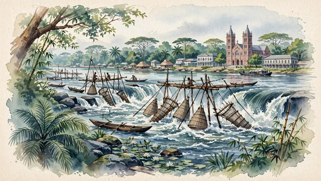
What guided this image
- Landmarks
- Wagenia Fisheries; Romanesque Cathédrale Notre-Dame du Rosaire; Congo River; Tshopo River Falls; Belgian; Congolese; lush Congo Basin equatorial rainforest flora; Lualaba-Congo
- Viewpoint
- Favor the classic viewpoint looking across the rushing rapids of Boyoma Falls toward the intricate wooden Wagenia fishing scaffolds with the lush rainforest shore and distant cathedral spires in the background, showing rainforest leaves and river rocks in the foreground, the foamy rapids and timber scaffolds in the middle-ground, and the vast Congo River rainforest horizon fading in the background.
- Palette
- Green should be the predominant color, especially in the multi-tiered equatorial rainforest canopy, oil palm groves along the river, and riverbank vegetation.
- Guarded against
- Not Kinshasa, Lubumbashi, or Goma
Population1,181,788Wikidata: 935,977
Coordinates0.52°N, 25.19°E
Elevation447 m
Area1,910 km²
Time zoneAfrica/LubumbashiUTC+2
Solar noon12:19clock runs 0.3 h ahead of the sun
Through the Earth
Dig straight through the Earth from Kisangani and you surface nearest to Banana Village, Kiribati — 398 km from the exact antipodal point.
Nearest cities in the atlas
| Kigali | RW | 607 km |
| Gitega | BI | 685 km |
| Mbuji-Mayi | CD | 762 km |
| Kananga | CD | 777 km |
| Kampala | UG | 822 km |
| Bangui | CF | 852 km |
| Juba | SS | 858 km |
| Mwanza | TZ | 921 km |
Twinned cities
Wikidata records no twinned cities for Kisangani inside this atlas.
This city sits on
- Democratic Republic of the Congocountry
- 0Nparallel
- UTC+2offset