
City
Lubumbashi
Democratic Republic of the Congo
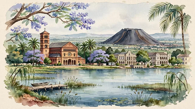
What guided this image
- Landmarks
- Cathédrale Saints-Pierre-et-Paul; Art Deco; Lake Kipopo; University of Lubumbashi; lush Katanga high-plateau miombo woodland flora
- Viewpoint
- Favor the classic viewpoint looking across the tree-lined square toward Saints Peter and Paul Cathedral with palm trees and colonial facades, or looking across the calm waters of Lake Kipopo toward the distinctive dark silhouette of the Terril, showing jacaranda and palm branches in the foreground, the cathedral or lake in the middle-ground, and the vast Katanga plateau horizon fading in the background.
- Palette
- Green should be the predominant color, especially in the thick miombo woodlands of the plateau, royal palms along the boulevards, and Lake Kipopo parklands.
- Guarded against
- Not Kinshasa, Kananga, or Goma
Population2,221,925Wikidata: 1,786,397
Coordinates11.66°S, 27.48°E
Elevation1,208 m
Area747,000,000 km²
Time zoneAfrica/LubumbashiUTC+2
Solar noon12:10clock runs 0.2 h ahead of the sun
Through the Earth
Dig straight through the Earth from Lubumbashi and you surface in open ocean, nearest to Discovery Harbor, United States — 886 km from the exact antipodal point.
Nearest cities in the atlas
| Lusaka | ZM | 426 km |
| Lilongwe | MW | 731 km |
| Mbuji-Mayi | CD | 748 km |
| Harare | ZW | 786 km |
| Kananga | CD | 848 km |
| Gitega | BI | 954 km |
| Dodoma | TZ | 1,093 km |
| Kigali | RW | 1,117 km |
Twinned cities
Wikidata records no twinned cities for Lubumbashi inside this atlas.
This city sits on
- Democratic Republic of the Congocountry
- 12Sparallel
- UTC+2offset