
City
Sapporo
Japan
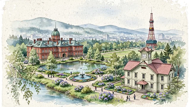
What guided this image
- Landmarks
- Odori Park; Former Hokkaido Government Office; Sapporo Clock Tower; Toyohira River; distinctive Meiji-era frontier architecture; northern Hokkaido flora; Meiji
- Viewpoint
- Favor the classic viewpoint looking across the landscape toward the signature landmarks of Sapporo, showing regional foliage and foreground textures, the iconic architectural monuments in the middle-ground, and the distant horizon fading in the background.
- Palette
- Green should be the predominant color, especially in white birches, Japanese elms in Odori Park, and blooming lilacs.
Population1,973,832Wikidata: 1,959,313
Coordinates43.07°N, 141.35°E
Elevation5 m
Area1,121 km²
Time zoneAsia/TokyoUTC+9
Solar noon11:35clock runs 0.4 h behind the sun
Through the Earth
Dig straight through the Earth from Sapporo and you surface in open ocean, nearest to Grytviken, South Georgia and the South Sandwich Islands — 1,256 km from the exact antipodal point.
Nearest cities in the atlas
| Sendai | JP | 535 km |
| Saitama | JP | 809 km |
| Tokyo | JP | 833 km |
| Kawasaki | JP | 851 km |
| Yokohama | JP | 862 km |
| Nagoya | JP | 957 km |
| Kyoto | JP | 1,017 km |
| Osaka | JP | 1,060 km |
Twinned cities
- Adana TR
- Daejeon KR
- Munich DE
- Novosibirsk RU
- Shenyang CN
5 of 9 twinned cities are in this atlas. See the full network →