
City
Tokyo
Capital of Japan
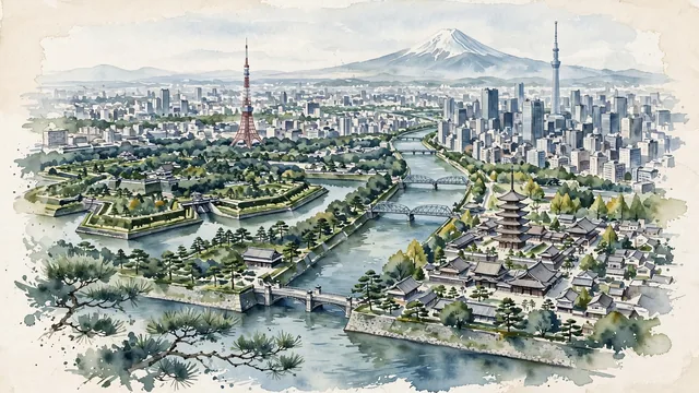
What guided this image
- Landmarks
- Tokyo Tower; Tokyo Skytree; Sensō-ji; Tokyo Imperial Palace; Sumida River; Shinjuku; lush urban greenery; Mount Fuji
- Viewpoint
- Favor an elevated viewpoint overlooking the city from the east or south (such as looking across the Sumida River or from Roppongi Hills), showing river waterways in the foreground, Tokyo Tower and temple pagodas in the middle-ground, and the distant snowy silhouette of Mount Fuji anchoring the horizon.
- Palette
- Green should be the predominant color, especially in the Imperial Palace gardens, Meiji Shrine forest, parklands, and ginkgo-lined avenues.
- Guarded against
- Not a generic futuristic megalopolis or cyberpunk cartoon
Population9,733,276Wikidata: 14,047,594
Coordinates35.69°N, 139.69°E
Elevation6 m
Area2,194 km²
Time zoneAsia/TokyoUTC+9
Solar noon11:41clock runs 0.3 h behind the sun
Through the Earth
Dig straight through the Earth from Tokyo and you surface in open ocean, nearest to Balneário Pinhal, Brazil — 1,105 km from the exact antipodal point.
Nearest cities in the atlas
| Kawasaki | JP | 19 km |
| Saitama | JP | 25 km |
| Yokohama | JP | 29 km |
| Nagoya | JP | 258 km |
| Sendai | JP | 305 km |
| Kyoto | JP | 365 km |
| Osaka | JP | 397 km |
| Kobe | JP | 425 km |
Twinned cities
- Amman JO
- Beijing CN
- Berlin DE
- Casablanca MA
- Damascus SY
- Delhi IN
- Jakarta ID
- London GB
- Moscow RU
- New York City US
- Paris FR
- Rome IT
- São Paulo BR
- Seoul KR
14 of 17 twinned cities are in this atlas. See the full network →