
City
Wellington
Capital of New Zealand
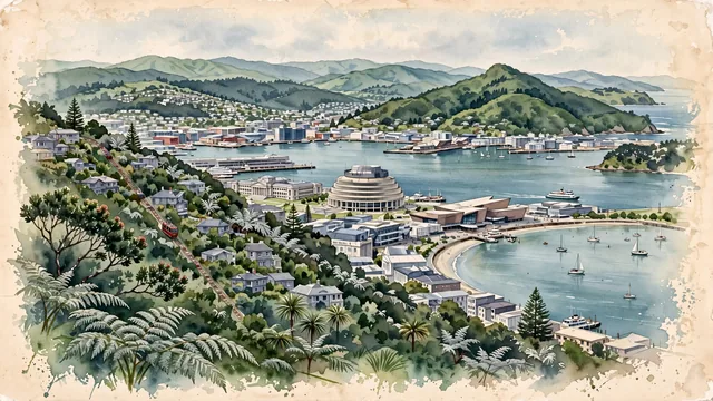
What guided this image
- Landmarks
- Beehive; Kelburn and the Botanic Garden; Te Papa Tongarewa; Mount Victoria; Victorian and Edwardian; Oriental Bay; lush native bush
- Viewpoint
- Favor the classic elevated viewpoint from Mount Victoria or the Kelburn lookout looking across the harbor toward the city center, showing native ferns and hillside villas in the foreground, the curved waterfront, Te Papa, and the Beehive in the middle-ground, and the rolling green Remutaka ranges across the water in the background.
- Palette
- Green should be the predominant color, especially in the native bush covering Mount Victoria and Tinakori Hill, the Botanic Garden, and coastal pōhutukawa trees.
- Guarded against
- Avoid confusing Wellington with Auckland (no Sky Tower or volcanic cones); Wellington's defining physical hallmark is its steep amphitheater hills dropping directly into a deep natural harbor.
Population381,900Wikidata: 216,200
Coordinates41.29°S, 174.78°E
Elevation0 m
Area444 km²
Time zonePacific/AucklandUTC+13
Solar noon13:21clock runs 1.3 h ahead of the sun
Through the Earth
Dig straight through the Earth from Wellington and you surface nearest to Alaejos, Spain — 2 km from the exact antipodal point.
Nearest cities in the atlas
| Auckland | NZ | 494 km |
| Sydney | AU | 2,226 km |
| Canberra | AU | 2,327 km |
| Nuku‘alofa | TO | 2,431 km |
| Brisbane | AU | 2,507 km |
| Melbourne | AU | 2,573 km |
| Suva | FJ | 2,598 km |
| Port-Vila | VU | 2,690 km |
Twinned cities
- Beijing CN
1 of 1 twinned cities are in this atlas. See the full network →
This city sits on
- New Zealandcountry
- 42Sparallel
- UTC+13offset