
City
Brazzaville
Capital of Republic of the Congo
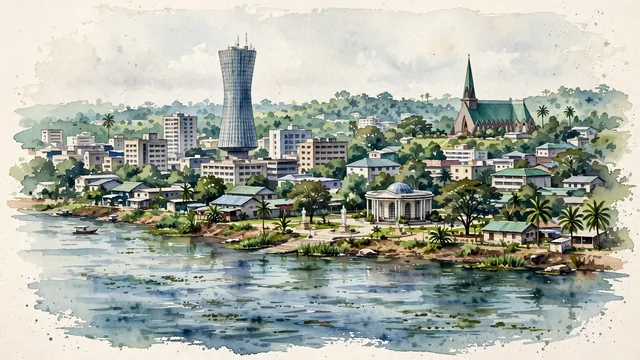
What guided this image
- Landmarks
- The Nabemba Tower; The Pierre Savorgnan de Brazza memorial; The Basilica of Sainte-Anne-du-Congo; Central Brazzaville; Preserve
- Viewpoint
- Use a moderately elevated river-side view toward the central city, retaining the recognizable tower and smaller inland landmarks at their actual distances instead of turning the familiar Congo panorama into a combined Brazzaville–Kinshasa skyline.
- Palette
- Muted botanical green should predominate in the actual urban trees and the basilica’s green roofing, with blue-grey river water and slate-grey building shadows maintaining the city’s low-rise structure.
- Guarded against
- Avoid making Brazzaville look like Kinshasa with its different skyline, Pointe-Noire with an Atlantic seafront, or a tiny settlement entirely surrounded by unbroken rainforest.
Population1,982,000Wikidata: 1,733,263
Coordinates4.27°S, 15.28°E
Elevation320 m
Area588 km²
Time zoneAfrica/BrazzavilleUTC+1
Solar noon11:59clock runs 0.0 h behind the sun
Through the Earth
Dig straight through the Earth from Brazzaville and you surface in open ocean, nearest to Napari Village, Kiribati — 592 km from the exact antipodal point.
Nearest cities in the atlas
| Kinshasa | CD | 7 km |
| Pointe-Noire | CG | 383 km |
| Luanda | AO | 556 km |
| Kananga | CD | 811 km |
| Ciudad de la Paz | GQ | 819 km |
| Libreville | GA | 829 km |
| Mbuji-Mayi | CD | 943 km |
| Yaoundé | CM | 997 km |
Twinned cities
- Dakar SN
- Kinshasa CD
- Nouakchott MR
- Rabat MA
- Windhoek NA
5 of 8 twinned cities are in this atlas. See the full network →
This city sits on
- Republic of the Congocountry
- 5Sparallel
- UTC+1offset