
City
Taipei
Capital of Taiwan
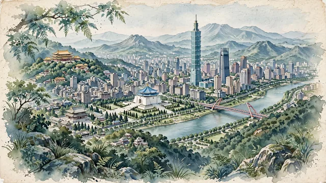
What guided this image
- Landmarks
- Taipei; National Chiang Kai-shek Memorial Hall; Grand Hotel; Longshan Temple; Keelung River; Elephant Mountain; Qing
- Viewpoint
- Favor the classic elevated viewpoint from the ridges of Elephant Mountain (Xiangshan) looking west over the Taipei Basin, showing subtropical fern trees and boulders in the foreground, Taipei 101 and the Xinyi district in the middle-ground, and the vast urban basin backed by the gentle blue-gray ridges of Yangmingshan.
- Palette
- Green should be the predominant color, especially in the steep forested slopes of Elephant Mountain and Yangmingshan, riverside parklands, and tree-lined boulevards.
- Guarded against
- Not Hong Kong, Tokyo, or a generic Asian megacity
Population7,871,900Wikidata: 2,704,810
Coordinates25.05°N, 121.53°E
Elevation10 m
Area272 km²
Time zoneAsia/TaipeiUTC+8
Solar noon11:54clock runs 0.1 h behind the sun
Through the Earth
Dig straight through the Earth from Taipei and you surface nearest to El Espinillo, Argentina — 11 km from the exact antipodal point.
Nearest cities in the atlas
| New Taipei City | TW | 7 km |
| Taichung | TW | 132 km |
| Fuzhou | CN | 249 km |
| Putian | CN | 257 km |
| Tainan | TW | 265 km |
| Quanzhou | CN | 297 km |
| Kaohsiung | TW | 297 km |
| Jinjiang | CN | 300 km |
Twinned cities
- Asunción PY
- Banjul GM
- Basseterre KN
- Belmopan BZ
- Bissau GW
- Castries LC
- Daegu KR
- Dakar SN
- Dallas US
- Guatemala City GT
- Houston US
- Jeddah SA
- Johannesburg ZA
- Kyiv UA
- La Paz BO
- Lilongwe MW
- Lima PE
- Lomé TG
- Los Angeles US
- Majuro MH
- Managua NI
- Manila PH
- Mbabane SZ
- Monrovia LR
- Ouagadougou BF
- Panama City PA
- Phoenix US
- Prague CZ
- Pretoria ZA
- Quezon City PH
- Quito EC
- Riga LV
- San José CR
- San Salvador SV
- Santo Domingo DO
- Seoul KR
- Tegucigalpa HN
- Ulan Bator MN
- Vilnius LT
- Warsaw PL
40 of 54 twinned cities are in this atlas. See the full network →