
City
Lima
Capital of Peru
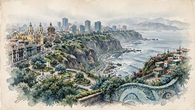
What guided this image
- Landmarks
- Costa Verde; Miraflores and Barranco; Parque del Amor; Cathedral of Lima; Miraflores and San Isidro; Barranco; Pacific Ocean
- Viewpoint
- Favor an elevated viewpoint along the curve of the Costa Verde (such as from Miraflores or Barranco), looking north or northwest along the sweeping coastal cliffs, showing the lush green clifftop parks, contemporary towers, and the vast Pacific Ocean stretching out below.
- Palette
- Green should be the predominant color, especially in the cliffside parks of the Malecón, public gardens, coastal lawns, and bougainvillea.
- Guarded against
- Not a generic South American or Mexican city
Population7,737,002Wikidata: 9,674,755
Coordinates12.04°S, 77.03°W
Elevation154 m
Area2,672 km²
Time zoneAmerica/LimaUTC−5
Solar noon12:08clock runs 0.1 h ahead of the sun
Through the Earth
Dig straight through the Earth from Lima and you surface nearest to Anlong Reab, Cambodia — 27 km from the exact antipodal point.
Nearest cities in the atlas
| Callao | PE | 11 km |
| Arequipa | PE | 765 km |
| La Paz | BO | 1,078 km |
| Guayaquil | EC | 1,139 km |
| Quito | EC | 1,323 km |
| Sucre | BO | 1,480 km |
| Santa Cruz de la Sierra | BO | 1,619 km |
| Cali | CO | 1,721 km |
Twinned cities
- Beijing CN
- Brasília BR
- Buenos Aires AR
- Kyiv UA
- Madrid ES
- Manila PH
- Mexico City MX
- Quito EC
- San José CR
- Santo Domingo DO
- São Paulo BR
- Taipei TW
- Tbilisi GE
- Tegucigalpa HN
14 of 21 twinned cities are in this atlas. See the full network →